Paths Layer
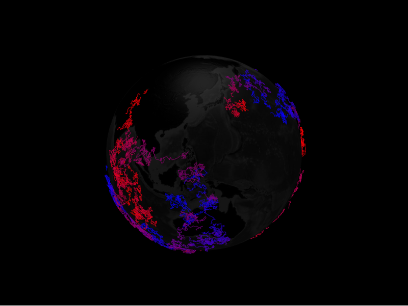
The paths layer draws a polyline that follows a sequence of coordinates along the
surface. Each line is a PathDatum.
from IPython.display import display

from pyglobegl import GlobeConfig, GlobeWidget, PathDatum, PathsLayerConfig

paths = [
    PathDatum(path=[(0, 0), (5, 5), (10, 0)], color="#66ccff", dash_length=0.02),
]

config = GlobeConfig(
    paths=PathsLayerConfig(paths_data=paths, path_transition_duration=0),
)

display(GlobeWidget(config=config))
PathDatum
A path is a list of (lat, lng) (or (lat, lng, altitude)) coordinates plus
appearance fields such as color, stroke, dash_length, dash_gap, and
dash_animate_time. Layer-level options like path_transition_duration live on
PathsLayerConfig.
Custom gradient
PathDatum.color is a single colour or a list of discrete stops. For a continuous
gradient along each path, set a layer-level path_color_fn — a
frontend Python callback mapping a position t
in [0, 1] (0 at the first vertex, 1 at the last) to a CSS colour string, typed
by the exported ColorInterpolator alias. When set it overrides the per-datum
colour for every path, and globe.gl samples it at data-change time.
from pyglobegl import ColorInterpolator, frontend_python


@frontend_python
def gradient(t: float) -> str:  # ColorInterpolator: (t in [0, 1]) -> CSS colour
    red = int(255 * (1 - t))
    return f"rgb({red},30,{int(255 * t)})"


config = GlobeConfig(paths=PathsLayerConfig(paths_data=paths, path_color_fn=gradient))
Pass None (the default) to keep per-datum colours, or swap it at runtime with
GlobeWidget.set_paths_color_fn(...).
Thin lines only
The gradient interpolator applies to the default thin lines. Setting
path_stroke switches globe.gl to fat lines, which support only the discrete
colour-list form of PathDatum.color, not a (t)-interpolator.
Custom tooltip
PathDatum.label is each path's hover tooltip. To compute one from the datum or
share a constant across the layer, set a layer-level path_label — a
frontend Python callback (datum → string),
a plain string (one tooltip for every path), or None (the default) to use each
datum's label. Swap it at runtime with GlobeWidget.set_path_label(...).
From a GeoDataFrame or trajectory
paths_from_gdf builds paths from LineString geometries, and
paths_from_mpd builds them from MovingPandas trajectories. See
GeoPandas helpers and
MovingPandas helpers.