Hexed Polygons Layer
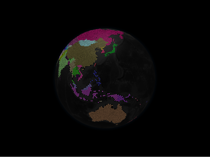
The hexed polygons layer fills GeoJSON polygons with a grid of H3 hexagons,
giving a stylised, tiled look. Each HexPolygonDatum wraps a polygon geometry.
from IPython.display import display
from geojson_pydantic import Polygon

from pyglobegl import (
    GlobeConfig,
    GlobeWidget,
    HexPolygonDatum,
    HexedPolygonsLayerConfig,
)

geometry = Polygon(
    type="Polygon",
    coordinates=[
        [(-10, 0), (-10, 10), (10, 10), (10, 0), (-10, 0)],
    ],
)

hexed = [
    HexPolygonDatum(geometry=geometry, color="#ffcc00", altitude=0.05),
]

config = GlobeConfig(
    hexed_polygons=HexedPolygonsLayerConfig(hex_polygons_data=hexed)
)

display(GlobeWidget(config=config))
HexPolygonDatum
A hexed polygon carries its geometry plus appearance fields such as color,
altitude, and resolution/margin controls on HexedPolygonsLayerConfig.
Ring winding order
Hexed polygons are filled with H3 cells, which ignores ring winding, so either orientation renders the same, as it does on the polygons layer.
Custom tooltip
HexPolygonDatum.label is each hexed polygon's hover tooltip. To compute one from
the datum or share a constant across the layer, set a layer-level
hex_polygon_label — a
frontend Python callback (datum → string),
a plain string (one tooltip for all), or None (the default) to use each datum's
label. Swap it at runtime with GlobeWidget.set_hex_polygon_label(...).
From a GeoDataFrame
hexed_polygons_from_gdf mirrors polygons_from_gdf, defaulting to a
polygons geometry column. See GeoPandas helpers.